

|
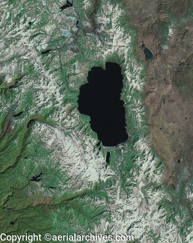
Aerial Archives maintains an extensive library of vertical photography of Lake Tahoe, including historical and current aerial photography. Available imagery includes georeferenced aerial photography of Lake Tahoe delivered both as prints and in digital form. This includes current and historical aerial maps of Lake Tahoe. Specialized services include delivery of geotiffs, customized labelling of aerial maps and output to specialized media. The coverage of aerial maps of Lake Tahoe can also be completely customized both with respect to scale and to show the entire communities or the whole region or only a set of blocks. To order an aerial map of Lake Tahoe please use the research request form. The aerial map of Lake Tahoe shown above is available for immediate online license or prints or, to obtain it optimized to your needs please contact Aerial Archives directly and reference the ID number in the caption to the photograph.
|