

Aerial Photographs of Imperial County for Immediate Download
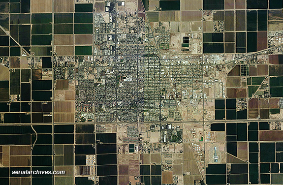
Current and historical aerial maps and satellite imagery of Imperial county, CA are available from Aerial Archives. Available imagery includes high resolution georeferenced aerial photography of Imperial county and high resolution satellite imagery. Aerial Archives provides aerial maps for all of Imperial county. This aerial photography can be delivered as a seamless view for the entire county or as customized aerial maps for for individual cities and towns. Among the cities and towns included are: Bard, Bombay Beach, Bonds Corner, Brawley, Calexico, Calipatria, El Centro, Felicity, Heber, Holtville, Imperial, Mount Signal, Niland, Ocotillo, Palo Verde, Salton City, Seeley, Thermal, Truckhaven, Westmorland, and Winterhaven, CA. Specialized services include delivery of geotiffs, customized labelling of aerial maps and output to specialized media. The aerial of coverage of aerial maps of Imperial County can also be completely customized both with respect to scale and to show the entire city or metropolitan area or only a set of blocks. The aerial map of El Centro in Imperial County, California shown above is available for immediate online license or prints, or to obtain this image optimized to your specifications, please contact Aerial Archives directly.
|
Aerial Maps and Satellite Imagery of the Mexican American Boarder
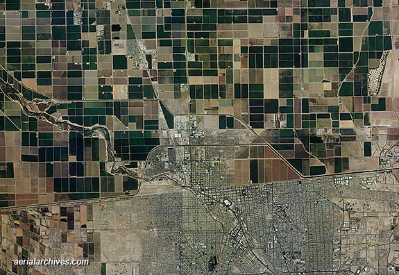
For current aerial photography coverage and satellite imagery of the Mexican American boarder in Imperial County, CA satellite acquisitions are more frequent than aerial photography acquisitions. If the resolution of high resolution satellite imagery is adequate for your project, you may wish to consider this imagery. You can view a sample of high resolution satellite imagery at high resolution satellite imagery. The aerial map of the Calexico shown above is available for immediate online license or prints, or to obtain this image optimized to your specifications, please contact Aerial Archives directly.
|
Historical Aerial Maps of Imperial County, California
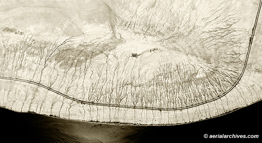
The historical aerial map of the Salton Sea shoreline in Imperial County shown above is available for immediate online license or prints, or to obtain this image optimized to your specifications, please contact Aerial Archives directly. For historical research of aerial photography of Imperial County, we recommend that you use the research request form . Additional information about the process of researching historical aerial photography for your location is available at aerial photography research. |